Day 9: Water in the valley
After the strain on my legs of hiking Half Dome yesterday, I wanted an easier day today. So my plan was to concentrate on what I hadn’t seen in Yosemite since 1984, that is, all the waterfalls, creeks and rivers flowing strongly with spring snowmelt.
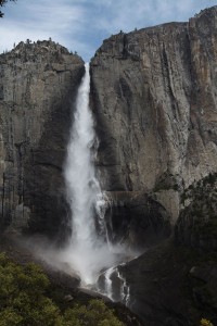
Unfortunately, my first choice for the day was hardly easy on my legs: the view of Yosemite Falls from halfway along the trail to the top of Yosemite Falls. But I took it slowly, and the view provided a worthwhile perspective on the falls, with a particularly good view of Upper Yosemite Falls.
I spent probably around a hour at the point I’d reached (several hundred metres beyond Columbia Rock, just past the first place where the falls come into view from the trail), watching as the wind blew the falls from side to side, and doing my best to take photos that don’t appear to be tilted.
After descending the trail, I stopped at the popular (and misty) viewing spot at the base of the falls for more photos. This provides good views of Lower Yosemite Falls, as well as a good spray for the front element of your lens.
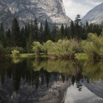
My next stop was Mirror Lake. Again, I hadn’t seen water in the lake since 1984, so I really didn’t have a good recollection of what it looked like. It is actually larger than I remembered, but with more silt creating sandbars in the lake, and generally making “perfect” photos harder to achieve. As it was, the wind kept the water far from mirror-smooth, so the so-called perfect photo would never be taken that day anyway.
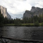
To complete the day’s tour of popular photo spots, I returned to my car (having been using the Valley Shuttle up until then) and drove to the point called Valley View, on the north side of the Merced River between El Capitan and the entrance to the valley. I’d taken photos from here in 1996 and last year, so I was interested to see how the scene was different with a strongly-flowing river in the foreground. It turned out that I’d left it a bit late in the day, and with rain clouds around and the sun a bit too low, it was a bit darker than I would have liked.
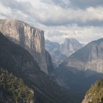
My next two stops were heading out of the valley; the first was the very popular Tunnel View, on the valley side of the Wawona tunnel. After that was Turtleback dome, which I had great hopes for. After a strenuous 10 minute hike up the road (closed to regular traffic), I reached the top of this little-visited spot, only to find it swarming with firetrucks. They were there to monitor a fire started by lightning nearby a few days earlier. Anyway, I found a path to a spot clear of vegetation blocking the view, and took some photos. It’s a good viewpoint, but not better than Tunnel View. I actually think the best view will be from Inspiration Point, up a steep trail from Tunnel View, but I haven’t been there yet. Maybe on my next trip to Yosemite…


